Overview Comprehensive solution for county-level low altitude economy Case Study
Investment and construction+local joint operation | Building a county-level low altitude industry community
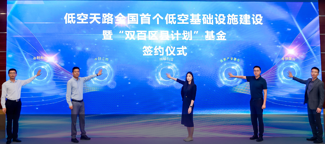
Zhongke Yuntu, in collaboration with ecological partners, has released the "Double Hundred District and County Plan" and the country's first 2 billion yuan low altitude infrastructure construction fund. Relying on this fund and adopting a joint investment+local joint venture operation model, we will promote the large-scale implementation of low altitude remote sensing networks and low altitude air route networks nationwide. We will collaborate with local platforms to establish local operating entities, achieve an integrated closed loop of investment, construction, and operation, and build a regional low altitude industry community.
120 +
Number of signed counties and districts
80 +
Establish a local joint venture operating company
2 billion +
Accumulated investment amount
Low altitude industry planning
Infrastructure construction
Low altitude scenario operation
Industrial investment promotion
Low altitude talent cultivation
Local joint venture operation mode
Establish a joint venture with local state-owned enterprises, continue to operate locally, and retain business taxes locally
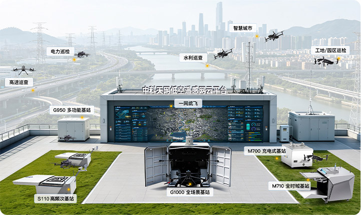
One network unified flight intensive scheduling
Relying on the low altitude remote sensing network to coordinate multiple departmental tasks, with one aircraft flying multiple times and resource reuse, to build a closed-loop inspection and disposal system
Sustainable hematopoietic business model
Backed by government scenarios and expanded to commercial scenarios, achieving self generation of projects
Mature county-level practical experience
Adapt to the endowments of different counties and output the full chain operational capabilities of airspace infrastructure scenarios investment promotion
Operation drives industrial development
Using local scenarios to drive industry landing, cultivating local low altitude talents, and building a county-level low altitude industry ecosystem
The disruptor and leader of the new form of low altitude economy in counties
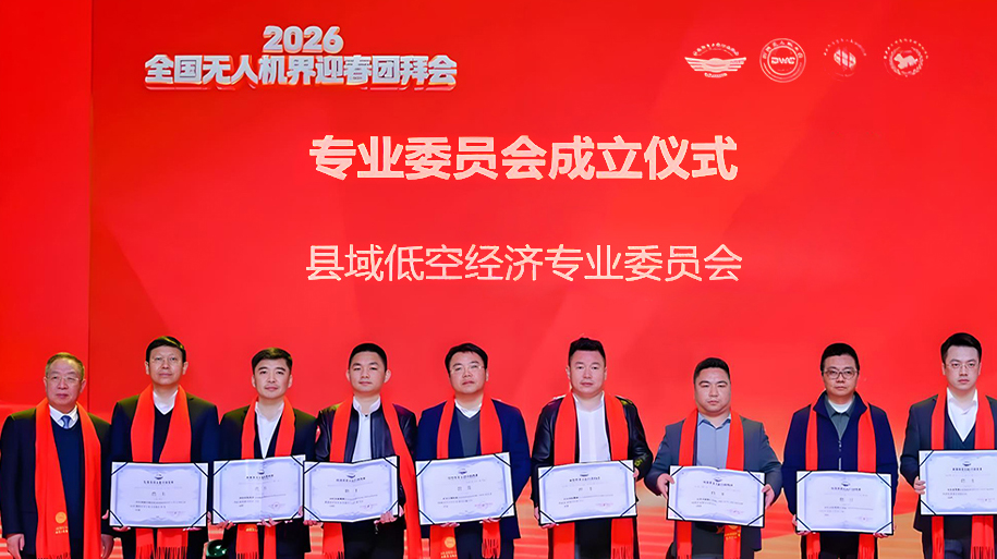
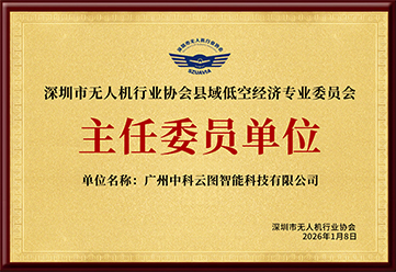
The first county-level low altitude economy professional committee in China, the Shenzhen UAV Industry Association County Low altitude Economy Professional Committee, has been established, with Zhongke Yuntu as the chairman unit, promoting the exploration of county-level low altitude economy from "fighting independently" to "rule co construction", and building the first industry platform for county-level low altitude economy from "pilot demonstration" to "systematic promotion".
Low altitude remote sensing network
Low altitude+logistics
Low altitude+cultural tourism
Building a new paradigm for urban low altitude governance
By relying on the low altitude remote sensing network to integrate low altitude hardware resources across the entire region, we aim to achieve a unified government flight network, complete cross departmental task coordination and scheduling, and achieve intensive operations with multiple flights and multiple uses for one aircraft. Build a business loop of "aerial discovery - intelligent recognition - dispatching and disposal - result feedback" to support normalized urban inspections and emergency combat. The platform integrates low altitude safety control capabilities to achieve global flight situational awareness, curb the risk of illegal flights, and achieve a two-way improvement in governance efficiency and low altitude safety assurance.
One stop low altitude logistics solution
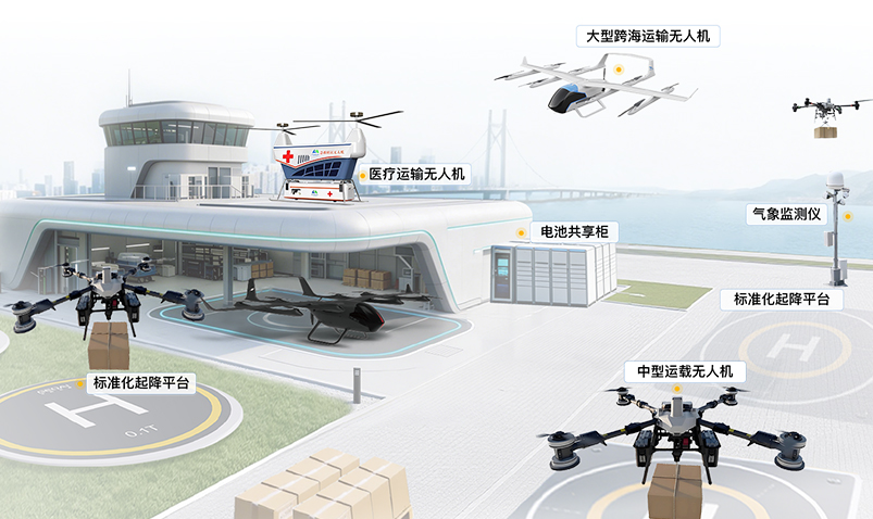
Integrating medical transportation drones, medium-sized transport drones, and large cross sea transportation drones, with supporting low altitude logistics stations, standardized takeoff and landing platforms, weather stations, and battery sharing cabinets, focusing on medical emergency, fresh e-commerce, specialty agriculture, high-end manufacturing and other scenarios, achieving point-to-point minute level delivery, breaking through terrain limitations, reducing end of pipe distribution costs, and improving logistics efficiency and coverage.
One stop low altitude cultural and tourism solution
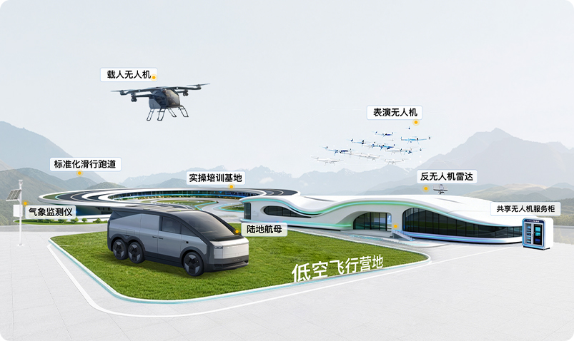
Integrating medical transportation drones, medium-sized transport drones, and large cross sea transportation drones, with supporting low altitude logistics stations, standardized takeoff and landing platforms, weather stations, and battery sharing cabinets, focusing on medical emergency, fresh e-commerce, specialty agriculture, high-end manufacturing and other scenarios, achieving point-to-point minute level delivery, breaking through terrain limitations, reducing end of pipe distribution costs, and improving logistics efficiency and coverage.
Resource management
Coordinate equipment and tasks, eliminate redundant construction, and improve equipment utilization efficiency;
Global scheduling closed-loop operation
Unified platform scheduling, online circulation of the entire process, achieving closed-loop governance;
Standardize airspace flight order
Weave a dense low altitude perception and supervision system, curb illegal "black flying", and build a strong barrier for low altitude safe operation;
Air ground collaborative response speed increase
Coordinate equipment and tasks, eliminate redundant construction, and improve equipment utilization efficiency;
Minute fast delivery
Point to point direct flight, minute level delivery; The delivery time in mountainous areas can be reduced by up to 85%, and emergency fresh food can be quickly circulated;
The risk of the entire chain is controllable
Unified platform scheduling, online circulation of the entire process, achieving closed-loop governance;
Reduce end of pipe logistics costs
Reduce investment in trucks, labor, and warehousing, and lower remote end costs by over 40%; Unmanned battery swapping improves efficiency and dilutes single ticket costs;
Break through the blind spots of traditional logistics
Constructing a multi-level low air distribution network for urban, rural, mountain, and sea areas, adapting to agricultural, medical, emergency, and other scenarios, and solving the "last 100 kilometers" problem in remote areas;
Add diversified profit formats
Breaking the dependence on tickets, building a multi-level cultural and tourism consumption system, and achieving growth in passenger flow, revenue, and efficiency;
Create exclusive differentiated labels for scenic spots
Say goodbye to homogeneous tourism, empower cultural tourism with technology, and achieve immersive experiences for all time periods and all people;
Empowering City IP
Empower scenic areas to upgrade, create cultural and tourism benchmarks, and achieve a value leap towards becoming a technological cultural and tourism destination;
Break through the blind spots of traditional logistics
Establish a fully automated airspace control system with one-stop landing operation to comprehensively avoid flight safety risks;
120+ Regional landing National leading enterprise in low altitude economy at the county level
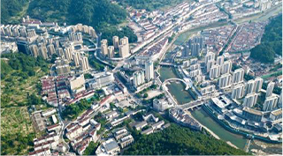
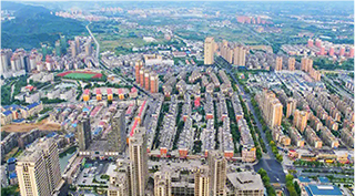
Zhongke Yuntu has taken the lead in forming replicable and promotable landing experience in the field of county-level low altitude economy. From the aviation culture IP empowerment of Enping, Guangdong to the three-dimensional inspection system of Sanjiang, Guangxi, and the real-time logistics in mountainous areas of Pan'an, Zhejiang, Zhongke Yuntu has built a low altitude operation system covering multiple scenarios such as grassroots governance, emergency rescue, environmental monitoring, and low altitude logistics with three core technologies: low altitude remote sensing network, low altitude route network, and low altitude large model. It has transformed the concept of county-level low altitude economy into a governance tool for daily operation.
For Industrial County - Hukou, Jiangxi
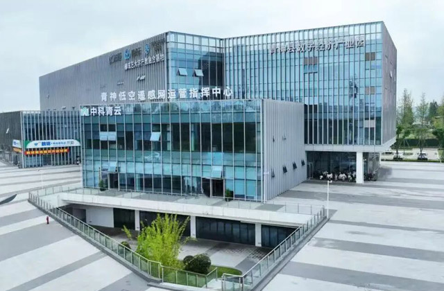
For Agricultural County - Sichuan Qingshen
For mountainous counties - Pan'an, Zhejiang
A resource-based county - Xuecheng, Shandong
For Aviation Culture County - Enping, Guangdong
Culture and Tourism County - Central District of Sichuan City
For Coastal County - Yunxiao, Fujian
— More —
Empowering Counties - Selected Implementation Cases
View more